|
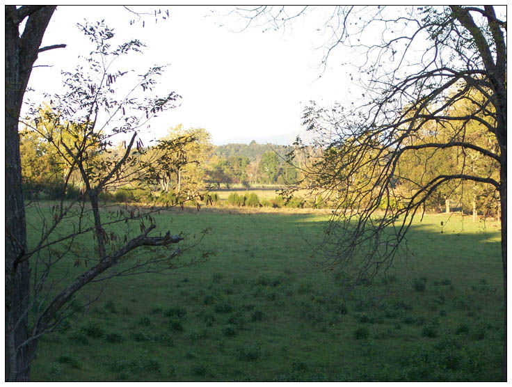
The plantation which Abraham Strickler had settled along the Shenandoah river in 1733, was called Egypt by him (because of its rich alluvial soils it has been said) and this area has been known by that name since that time. From Forerunners: A History or Genealogy of the Strickler Families Their Kith and Kin, by Harry M. Strickler (Harrisonburg, Virginia: 1925), pp. 22-24: |
|
Just to the north of Massanutten and on the same side of the river is Egypt. Roughly speaking, we might say the north gate is at Lick Branch, while the southern gate may be considered as being where a small stream comes down from the mountain and enters the river where it approaches the mountain. But Mr. Lee Strickler tells me that Egypt extended up into the lower part of Massanutten Bend, that the dividing line was a straight line, leaving the river some distance above the White House and running straight toward the mountain to a place called "Crates Hollow" about a mile north-west of Salem, and that the large body of land located just south of the White House bridge, whereon Abraham Strickler, Sr. lived, was always considered as being in Egypt. He also says that the northern limit of Egypt went beyond Lick Branch to a point south of J. W. Ruffner's brick mansion. These limits of Egypt are consistent with the lines of Abraham Strickler's first grant. His line starts four or five roads (320 rods equal one mile) up the river from the White House, then it runs N. 30 W. 414 rods, then runs almost due east, N. 80 E. 144 rods, then by a short line to the river, then down the river to a point where the river approaches the mountain, then it runs N. 39 E. 520 rods to the river, near Lick Branch, then N. 60 E. 120 rods, then N. 82 E. 20 rods, then N. 17 W. to the river, then up the river to the beginning. These lines take in lower Massanutten Bend and all of Egypt Bend, extending 120 rods beyond Lick Branch. Very early Abraham Strickler called his grant Egypt, and this explains why Egypt was considered as extending up into the Massanutten Bend and beyond Lick Branch. One of the ridges of the Massanutten Mountain ends in a knob just west of Egypt. This knob is known as Strickler's Knob and is so marked on the map of the U. S. Forestry Office. "Strickler's Short Horse Mountain" A similar knob south of New Market Gap is called Short Horse Mountain on the same map. I have called it "Strickler's Short Horse Mountain," an appellation taken from an old deed to land in this vicinity. Mr. Wm. Lee Strickler tells me that there was an old Indian trail leading up the steep right bank of the river above the mouth of Mill Creek, on the P. M. Kaufman lands (1914). He also says that there was a ford across the river in lower Egypt which saved residents in that section many miles in going to Luray. He tells me that his father told him that a member of the family was with Morgan at the battle of the Cowpens and that others were officers in Washington's Army, but he does not remember their names. He also informs me that there was a warehouse on the left bank of the river near the road in upper Egypt from which point flour and other produce gathered from Rockingham, Page, and Shenandoah were shipped on flat boats to the markets. Where our ancestors obtained their meat. After going some distance up Lick Branch or Lick Hollow from the river, we come to a point where the hollow widens into a marshy bottom, probably a hundred yards wide and much longer. At the upper end of this bottom I am told is the old deer lick, a wet marshy spot thirty yards in circumference probably. Here is where our ancestors came and lay in wait for their deer, and a shot form the trusty old rifle refilled the meat house. It is a very secluded spot between to high ridges. If one follows this hollow on up toward the mountain, he will come to a sulphur spring high on the mountain. This hollow above the bottom is very narrow, dark, and rough. Lick Branch is no doubt the same stream referred to in old deeds as "Elk Lick."
|
|
|

|
From Pioneers of Old Frederick County, Virginia, by Cecil O' Dell (Walsworth Pub. Co., Marceline, Mo. : 1995), pp. 442 - 443: |
|
Abrahm Strickler (b. 1680 c., of Pennsylvaina) purchased 1,000 acres from Jacob Stover and his wife Margaret (part of Stover's 5,000-acre 15 December 1733 Colony of Virginia patent land) for 84 pounds on 16 December 1735 (Tract 111-L1, L2 and L3...). These three tracts wer located east of Luray on U. S. Highway 211 on the west side of North River Shenandoah. Page County Highway 615 north and south from U.S. Highway 211 provides access to all three tracts. Strickler sold 100 acres of the 1,000-acre tract to Jacob Bowmer for 20 pounds on 29 July 1743 (Tract 111-L1...). Abraham was deceased by 14 April 1746 when Peter Ruffner was designated to serve as administrator of his estate with sureties provided by Mathias Selser and John Lionberger. On 12 June 1747, Lord Fairfax's surveyor George Hume laid off the division of Abraham's 1,000-acre tract (purchased from Jacob Stover) for distribution among his sons. One 263-acre tract (north of U. S. Highway 211 on Page County Highway 615, Tract 111, L-2...) was shared by sons Joseph, 102 acres; Jacob, 106 acres, and Abraham II, 55 acres. A second 384-acre tract (south of U. S. Highway 211, Tract 111-L3...) was shared by sons Benjamin, 201 acres and Isaac, 183 acres. The 384-acre tract is accessible by U. S. Highway 211 which crosses the north section and Page County Highway 615 on the west section.
|
|
|
 |
 |
 |
![]()
This page created on 08/07/01 15:47.